In the 1830s, London saw its first confirmed case of cholera, and the problem quickly grew into an epidemic. Officials assumed the disease was airborne, and thus efforts to end this orally transmitted disease did nothing to stop the spread.
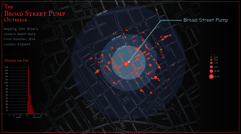
During the early 1850s, Dr. John Snow hypothesized that cholera was spread through contaminated water, and he began recording incidents of an outbreak near the Broad Street pump in 1854.
He later mapped his findings, which clearly showed the outbreak clustered around the Broad Street pump.
I created this map as a modern recreation of his map, using Dr. Snow's data prepared by Esri. The basemap is also derived from the original map of London that Dr. Snow used.